
Waukegan Neighbor Sources by Block
A block lookup needs sources with different jobs. Lake County GIS draws the legal geometry, the assessor assigns assessment roles, and recorded instruments document transactions. Waukegan ward and Neighborhood Policing Unit pages route civic questions. Historical shelves answer a dated question about past neighbors, not the current household.
| Source | What It Shows About a Block | Access |
|---|---|---|
| Tax Parcel Viewer | Intersecting parcels, lots, condominiums, subdivisions, roads and rights-of-way | Free map; inspected parcel layer has no owner field |
| Property tax search | PIN, owner or billing role, address, township, ZIP and assessment criteria | Free; use one search path at a time |
| Recording Division | Deeds, plats, liens, mortgages, legal descriptions, dates and party roles | Modern web index; earlier index books and terminals |
| Ward and NPU pages | Current civic boundary and public officer contact | Public maps and contact page; assignments change |
| WPL and WHS | Dated directories, atlases, Sanborn maps, newspapers and photos | Library or repository access; gaps exist |
| Community groups | Public group, district, event or association contact | Not a resident or member roster |
An assessment owner may live elsewhere, and an occupant may not appear in parcel records. Call each finding what it is: adjacent parcel, assessment owner, recorded party, same block, civic contact, or historical entry.
Mapping Waukegan Neighbor Parcels
The Lake County Tax Parcel Viewer can select a point, rectangle, circle, polygon, or line across Tax Parcels, Lots, Condominium, and Subdivision layers. Use the smallest shape that answers the block question. A broad circle can accidentally cross a major road or capture lots that are near on screen but not adjacent in law.
The inspected adjacent-parcel layer exposes PIN-like names, document numbers, parcel type, condominium status, and geometry.
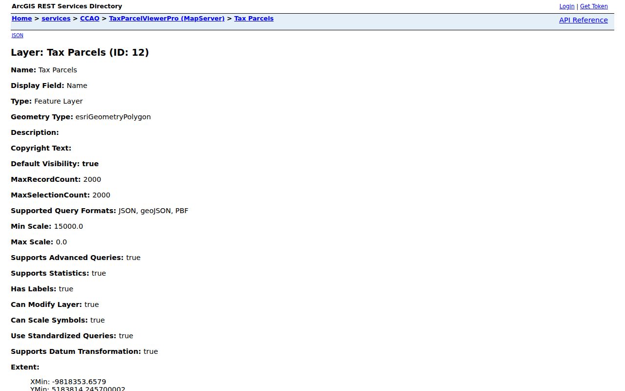
That layer does not expose owner or mailing fields. This is an important Waukegan quirk: GIS finds the shapes and PINs, then the assessor provides the assessment record. Keeping those steps separate prevents a map label from becoming an unsupported identity claim.
- Geocode the complete address and save the matched city, ZIP, and target parcel.
- Turn on road centerline, right-of-way, lots, parcel dimensions, subdivision, and condominium layers as needed.
- Select the target and only the parcels that touch or clearly form the immediate block.
- Search each PIN separately in the assessor portal, saving the assessment year and role shown.
- Use recorder documents only when a deed, plat, or legal-description question remains.
The full named-street chain belongs in the Waukegan street directory; a neighbors search should stay focused on the immediate block.
Reading Waukegan Block Boundaries
A street view can hide the record boundaries that matter. One building may contain several condominium PINs. One parcel may face a road but be separated by public right-of-way. An empty strip might be a lot, alley, private road, or mapped easement rather than part of the next home.
- Parcel
- A mapped unit used for tax and land records; it is not the same as a household.
- PIN
- The parcel identification number used to join map, assessment, and recorded-document sources.
- Right-of-way
- Land reserved for a public or private road and related use.
- Situs address
- The parcel's mapped location, distinct from a billing or mailing address.
The City of Waukegan maps page also publishes street, zoning, TIF, and nine ward maps. Save the map edition because boundaries can change. “Downtown,” “lakefront,” “North Side,” and “South Side” may be useful local labels, but none replaces a PIN, ward line, or incorporated-city boundary.
Checking Waukegan Neighbor Records
The Lake County property search accepts Parcel ID, owner, billing name, or an address path with number, direction, street, suffix, unit, township, city, and ZIP. Its one-path notice matters. Search the PIN from GIS rather than blending a partial owner name and street that may create a false join.
Compare the situs address with any billing address and note the assessment year. A matching mailing address may support owner-occupancy, but it still does not list every person in the home. Exemption fields, when shown, should not be converted into a profile of a private household.
If the parcel trail needs a filed deed or plat, the recorder's advanced search adds parcel number, address, legal description, subdivision, party, document number, book and page. Earlier records may require pre-1980 index books or an in-person terminal. The online range is a coverage line, not the age of the block.
Waukegan Filing Alerts by Name
Lake County's Property Alert allows free email alerts when a recorded real-property filing matches a registered name or keyword. The captured sign-up route is useful after a resident has identified the exact form of an owner name or parcel-related term.
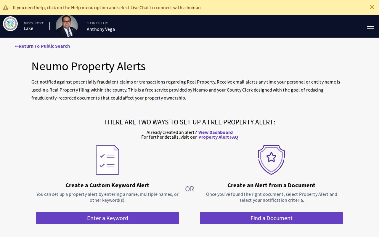
An alert reports a matching filing; it does not decide whether the document is valid, fraudulent, or tied to the intended person. Open the instrument through the official recorder route and compare the document number, date, party role, and legal description. Property Alert is a monitoring aid, not a neighbor roster or a fraud guarantee.
Note: Names can vary across deeds, so an alert term should match the recorded form without adding sensitive details about Waukegan neighbors.
Waukegan Neighborhood Contact Routes
No official citywide neighborhood-association registry was found. Waukegan does publish public civic routes that are more reliable for a block issue than searching for private member names. Ward maps provide a reproducible boundary, and the Neighborhood Policing Unit page pairs officers with the city's nine wards.
The Neighborhood Policing contacts page shows the current ward pairings and phone routes.
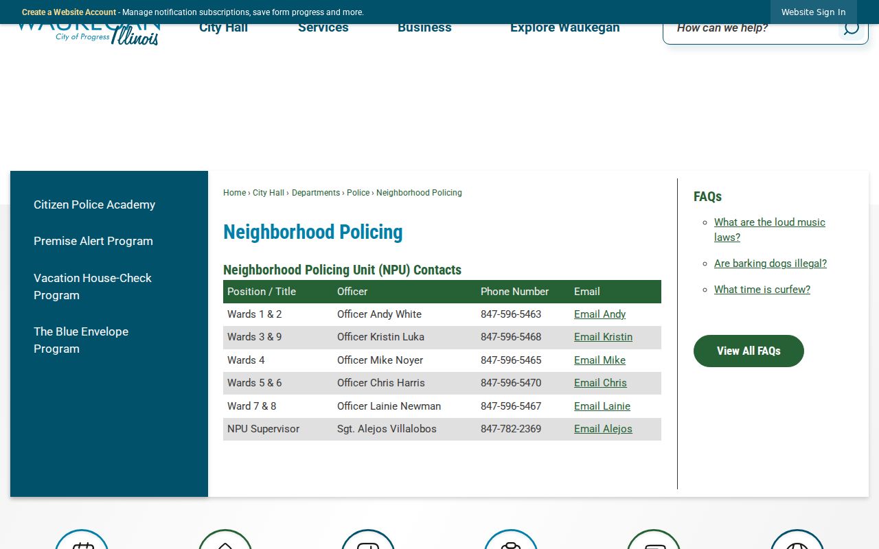
Those names are public officers assigned to civic areas, not people who live on a block. Verify the current page before calling because assignments can change.
Neighborhood Policing
Ward-based public safety and civic routing for Wards 1 through 9. Use the city map and current contact page.
City Resource Directory
Public organization leads include Main Street, the harbor advisory group, library, park district, township, chamber, and Historical Society.
Continental Village
The private owners association has its own public site and privacy rules. Public contact or boundary information is not a membership list.
Waukegan Neighbors Across Boundaries
A Waukegan postal label does not guarantee that a parcel is inside the incorporated city. City profile material spans six townships and nine wards, while ZIP, assessor municipality, township, ward, Census geography, association boundary, and parcel are different layers. Confirm the exact address with USPS, then use the assessor and city map for municipal and parcel context.
This difference matters along an edge. A nearby lot may share a postal city yet have another municipal government or township service. The official block result should therefore carry separate fields for ZIP, city, township, ward, and PIN. Do not flatten them into one neighborhood name.
Waukegan's historic block context also changed. Compare a dated atlas or city directory with Sanborn fire-insurance maps and current parcel geometry. The result can show changes in buildings, lots, and streets without publishing a current list of private people.
Official Waukegan Neighbor Tools
Official records and commercial neighbor tools answer different questions. The official route identifies the custodian, date, role, and coverage gap. A compiled commercial result may mix parcel data, old directories, licensing records, court extracts, and marketing files without preserving those distinctions.
| Question | Official block sources | Commercial compilation |
|---|---|---|
| Source date | Assessment year, filing date, map edition, directory year | May be unclear or mixed |
| Person's role | Owner, recorded party, historic entry, or civic contact | Roles may be merged |
| Correction | Ask the named custodian | Process and update speed vary |
| Block boundary | Parcel, road, ward, and city layers are separate | Radius may ignore legal boundaries |
Use a compiled result only as an unverified lead. For local curiosity, civic routing, family history, or personal safety, the least sensitive official source is usually enough.
Privacy for Waukegan Neighbor Lookups
Adjacent parcel records do not reveal every occupant, household member, mail recipient, utility customer, or protected voter. Waukegan code-compliance complaints are not public. Police and incident records can be redacted. Illinois Address Confidentiality Program participants may use substitute addresses, and sealed court matters remain closed.
Voter registration is an individual statutory lookup, not a public way to build a block list. Ward and NPU contacts route civic concerns but do not authorize release of resident identities. Historical directories also need dates: a printed name proves an entry in that edition, not current presence.
Lawful use. Research Waukegan neighbors for lawful personal, civic, or historical purposes only. Never use a block search to watch, stalk, harass, threaten, or intimidate another person.
Stop after the question is answered. A safe output labels geometry and record roles, omits protected details, and leaves unresolved people unresolved.