
Waukegan ZIP Directory Coverage
Three core candidates appear in Waukegan city, county, and postal material: 60079, 60085, and 60087. Two more codes appear in an official USPS logistics grouping, but the reviewed city and county sources did not establish them as incorporated-city ZIPs. That difference belongs at the start of any ZIP code directory search.
| ZIP | Waukegan relationship | Post office | Verification note |
|---|---|---|---|
| 60079 | Postal designation in city and USPS material; may include PO box, rural-edge, or nearby delivery geography | Waukegan label grouping | Run the exact address through USPS |
| 60085 | Core postal reference used by downtown and civic addresses | Waukegan Post Office, 326 N Genesee; Edison Square, 1519 N Lewis | Postal code is not the city line |
| 60087 | North/east Waukegan-area delivery and nearby edge geography | Waukegan-related routing | Verify parcel municipality |
| 60096 | USPS FAST label grouping only | No Waukegan station established in research | Do not count as city ZIP without an address |
| 60099 | USPS FAST label grouping only | No Waukegan station established in research | Likely nearby delivery geography |
The county health assessment lists 60085 and 60087. City materials and postal references also surface 60079. The extra 60096 and 60099 rows preserve what the USPS routing file says without turning a mail-container label into a city boundary.
Verify a Waukegan ZIP Code
The USPS ZIP Code Lookup offers address, city-and-state, and cities-by-ZIP modes. Its address form takes street, city, state, and ZIP. A returned delivery label validates postal routing at the time of the search. USPS also warns that a result does not establish that a named person or company is at that address.
- Enter the complete street address, unit, city, and state in USPS lookup. Save the returned postal city and ZIP.
- Open the Lake County assessor and search the address or ZIP. Record municipality and township separately.
- Geocode the address in county GIS. Capture the matched address, Postal field, PIN, and parcel geometry.
- If a known person is being checked, use the official Illinois voter form only with its required name, birth date, ZIP, and street fields.
- Once the ZIP narrows the area, use the Waukegan street directory for the street-level parcel and deed chain.
This process keeps the Waukegan ZIP code directory focused on geography. It does not turn a ZIP-wide result set into a list of residents.
Search Waukegan Property by ZIP
The Lake County advanced property search includes ZIP Code, Municipality, Township, Street Name, owner, parcel, sale, school district, land use, and assessment neighborhood criteria. The basic search also provides an eight-character ZIP field and separate City Name control. Keeping those fields distinct is one of the strongest checks on a postal-city mismatch.
| Portal field | Input type | What it narrows |
|---|---|---|
| ZIP Code | Text, up to 8 characters in basic search | Assessment records carrying that ZIP |
| Municipality | Advanced criterion | City jurisdiction in assessment data |
| Township | Dropdown / advanced criterion | Assessment township |
| Street Name | Text criterion | Named street within the result area |
| Parcel ID | Text without dashes | One known parcel |
| Sort / page size | Owner, address, or PIN; 10-50 rows | Organizes results, not proof of occupancy |
The advanced assessment screen shows the ZIP-capable criteria used in this Waukegan ZIP code directory.
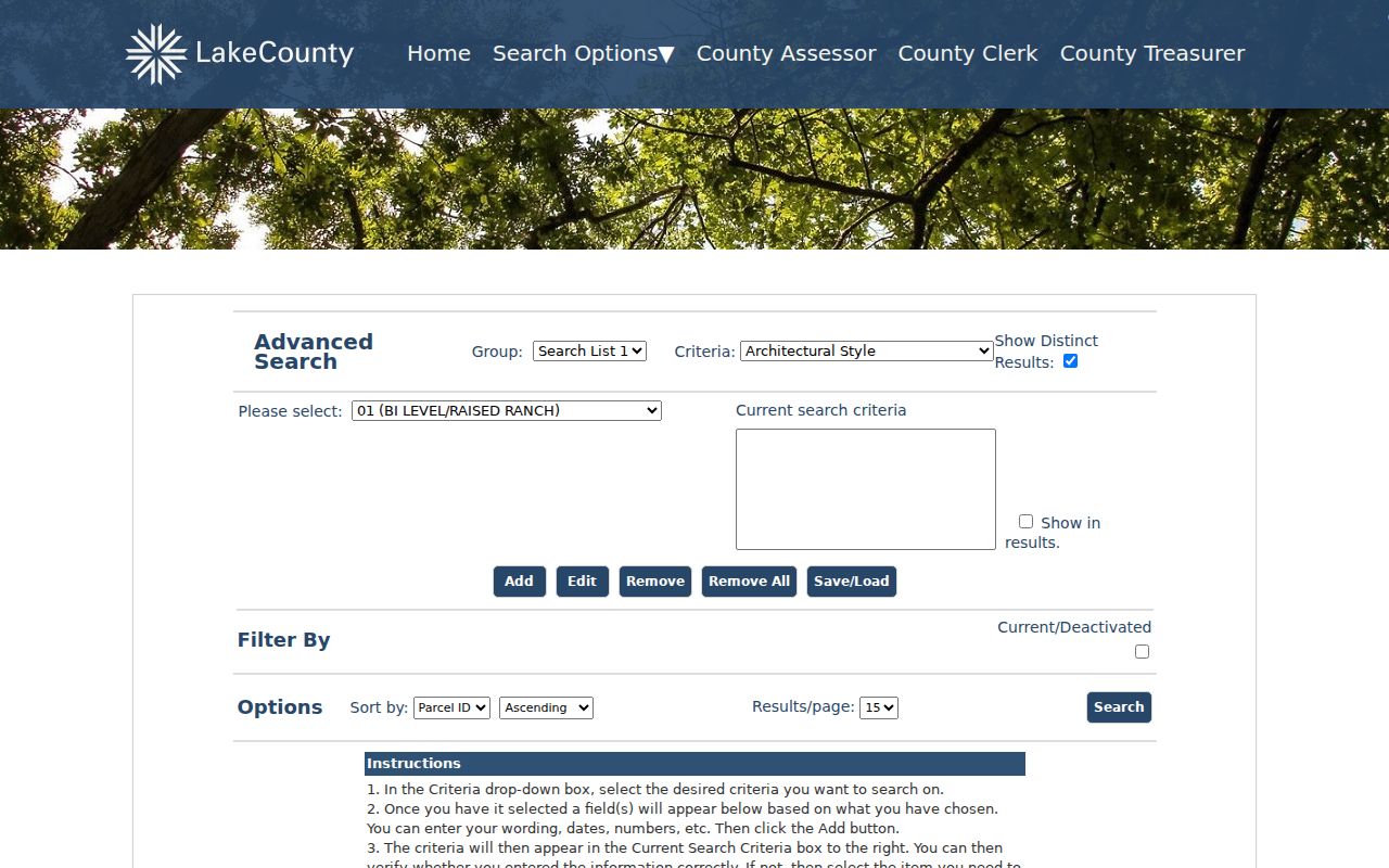
A ZIP filter can gather parcel records, but each row still reflects assessment roles and the portal's current certified data, not everyone present in the area.
Geocode Waukegan ZIP Addresses
Lake County's composite geocoder uses the hint “Find address and ZIP.” Its return fields include Address or Place, City, Subregion, Region, Postal, PostalExt, Match_addr, LongLabel, and ShortLabel. That makes it a useful bridge from a postal string to a map candidate.
The Lake County address geocoder service exposes those address and postal fields.
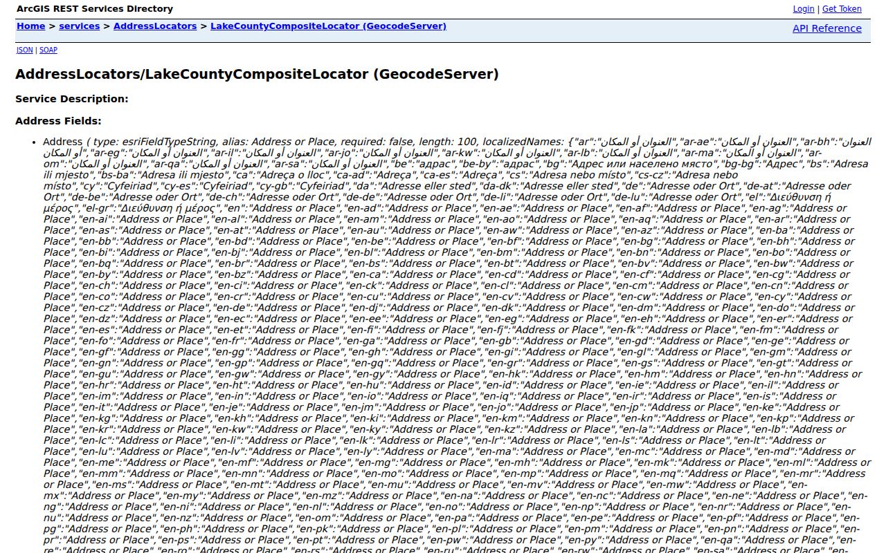
A match still needs the Tax Parcel Viewer and assessor. The geocoder can suggest an address and ZIP, but it does not identify an owner or resident. Capture its matched form instead of silently correcting the original query.
Parcel identifiers also differ by system. GIS returned a PIN-like value without dashes, the assessor accepts parcel text without dashes, and recorder guidance shows a dashed wildcard example. Preserve the format displayed by each source.
Waukegan ZIP and City Limits
Waukegan lies across six townships and nine wards. A single address may therefore carry a USPS ZIP and postal city, an incorporated municipality, a township, a ward or precinct, a Census ZCTA, and one county parcel. These are not synonyms. An edge address can use Waukegan for mail while lying in a nearby municipality, or can fall inside the city while its wider postal data includes places beyond it.
| Geography | Meaning and source |
|---|---|
| USPS ZIP | Mail routing; verify in USPS exact-address lookup |
| Postal city | Delivery label; may extend across municipal boundaries |
| Municipal city | Incorporation and city services; verify by city map and assessor |
| Township | County assessment or civic geography |
| Census ZCTA | A statistical approximation, not a delivery route |
| Ward / precinct | Current election geography that can change |
This comparison is the key quirk in a Waukegan ZIP code directory. The label “Waukegan” answers a mail question first. It does not by itself prove the legal city, school area, ward, parcel, or a person's presence.
Boundary check. Compare USPS, assessor municipality, township, city map, and GIS before describing any edge address as inside Waukegan.
Waukegan ZIP Codes Are Not ZCTAs
The Census Bureau builds ZIP Code Tabulation Areas, or ZCTAs, as generalized statistical areas. They help publish population and other aggregate data. They do not reproduce live USPS carrier routes. A ZIP has mail-delivery work; a ZCTA has census-data work.
The Census QuickFacts profile for Waukegan city reported 89,321 people in the 2020 Census and a 2025 estimate of 87,940 when researched. The city profile used another figure, most likely from a different vintage or definition. Label the source and year rather than smoothing those numbers together.
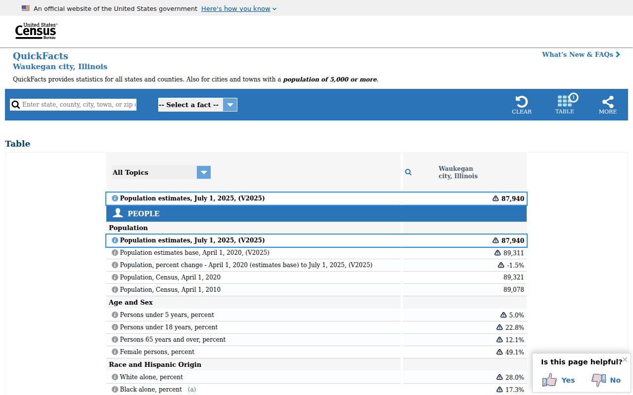
The city-level profile shown here must not be replaced with a sum of ZIP or ZCTA populations. ZIP areas can include land and people outside Waukegan's incorporated boundary.
Note: Use ZCTA figures only as aggregate context, never as proof that a person or parcel lies in the City of Waukegan.
Read Waukegan Postal Terms
Postal terms describe routing at several levels. Keeping them clear prevents a ZIP code lookup from claiming more precision than the source supplies.
- ZIP code
- A USPS routing code for mail delivery, not a legal municipal boundary.
- ZIP+4
- The five-digit ZIP plus four digits that narrow a delivery segment, building, or group of boxes.
- PO-box ZIP
- A ZIP used mainly or only for post-office boxes; no Waukegan-specific designation was confirmed in the research.
- Unique ZIP
- A code assigned to one large recipient; no Waukegan unique-institution ZIP was confirmed.
- Carrier route
- A USPS delivery grouping below the ZIP level that can change with operations.
No official Waukegan-specific ZIP split or realignment notice was located. USPS bulletins document container and label groupings, but a routing-label update does not prove a city boundary change. The Waukegan ZIP code directory therefore retains gaps rather than inventing a split date, PO-box-only code, or per-ZIP population.
Historic Waukegan ZIP Clues
Old directories and newspapers should be read with their publication year and printed postal line. A historic address may predate ZIP codes, use a different zone, or carry a street number that later changed. Waukegan's house-history guide documents one 1922-era Genesee Street renumbering. It cannot be applied as a citywide formula, but it warns against forcing an old address into a modern ZIP.
Compare a dated directory with an atlas, Sanborn map, legal description, and current parcel. If the item predates March 31, 1849, also search Little Fort, Waukegan's former name. Postal clues help place a source in time. They do not establish continuous residence.
Limits of Waukegan ZIP Lookups
The Illinois voter lookup requires a five-digit ZIP before it reveals street controls, but it also requires a known name and birth date. Lake County electronic voter files are restricted. The recorder has no ZIP-specific field in its inspected advanced form, so deed research must move from address to PIN, party, document number, or legal description.
A ZIP-wide search can over-include nearby delivery areas and return stale or misjoined names in commercial tools. Use the official postal, assessor, GIS, and custodian routes instead. A blank result means only that the search did not locate a match. It does not establish that no record exists.
Lawful use. Use Waukegan ZIP searches for lawful personal research, and never to stalk, harass, threaten, or expose a protected address.